
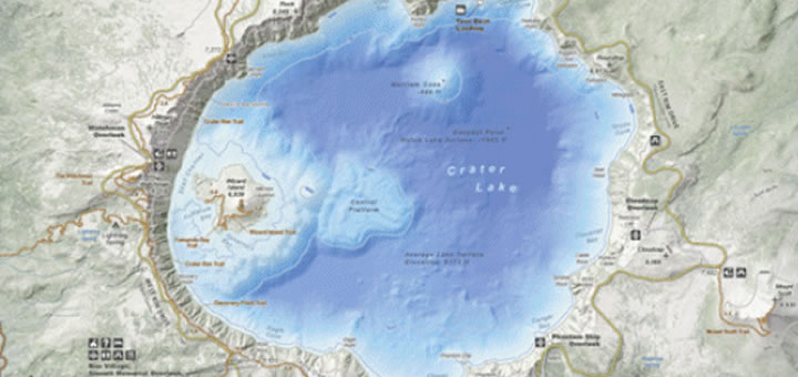
A cool new map of the Crater Lake area is now out — based on Lidar (or light-detection images).
Because it’s based on remote sensing technology similar to radar, the images are very dense and accurate.
The new-generation map covers area trails, like the Pacific Crest Trail.
Click here to see a preview.
Source: Klamath Falls Herald Tribune
Rebecca Webb is a cofounder and Board President at Portland Radio Project Listen Now
Latest posts by Rebecca Webb (see all)
- New Festival Showcases Multicultural Readings & Films - August 18, 2021
- Parisalexa Plays Portland! - August 9, 2021
- Pardon our Dust! - June 29, 2021


The LIDAR looks cool, but the title could cause confusion. The lake itself was mapped back in 2000 using a multibeam echosounder. LIDAR is typically for the earth’s surface, not bodies of water. Only recently have Lasers started to map very shallow water in clear conditions.